All publications
2026
- Laurens Arp, Peter M. van Bodegom, Holger H. Hoos and Mitra Baratchi. Characterising the Ill-posedness of PROSAIL Inversion for Biophysical Parameter Retrieval. European Journal of Remote Sensing, 59(1). 2026. view publication •project page
2024
- Laurens Arp, Holger Hoos, Peter van Bodegom, Alistair Francis, James Wheeler, Dean van Laar and Mitra Baratchi. Training-free thick cloud removal for Sentinel-2 imagery using value propagation interpolation. ISPRS Journal of Photogrammetry and Remote Sensing, 216:168–184, 2024. view publication •project page
- Julia Wąsala, Suzanne Marselis, Laurens Arp, Holger Hoos, Nicolas Longépé and Mitra Baratchi. AutoSR4EO: An AutoML Approach to Super-Resolution for Earth Observation Images. Remote Sensing, 16(3): 443. 2024. view publication
2022
- Laurens Arp, Mitra Baratchi and Holger Hoos. VPint: value propagation-based spatial interpolation. Data Mining and Knowledge Discovery, 36(5):1647–1678, 2022. view publication •project page
2020
- Laurens Arp, Dyon van Vreumingen, Daniela Gawehns and Mitra Baratchi. Dynamic macro scale traffic flow optimisation using crowd-sourced urban movement data. 21st IEEE International Conference on Mobile Data Management (MDM), 168–177. 2020. view publication
Main-author publication project pages
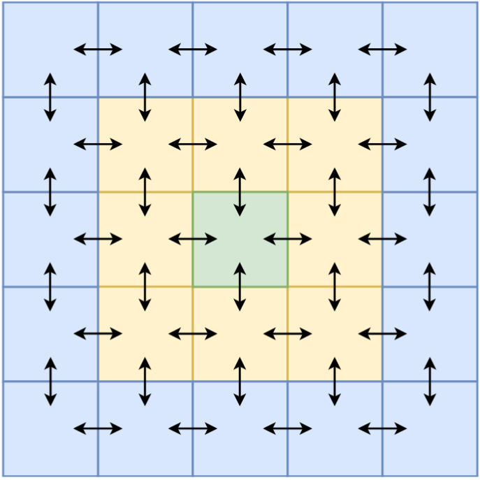
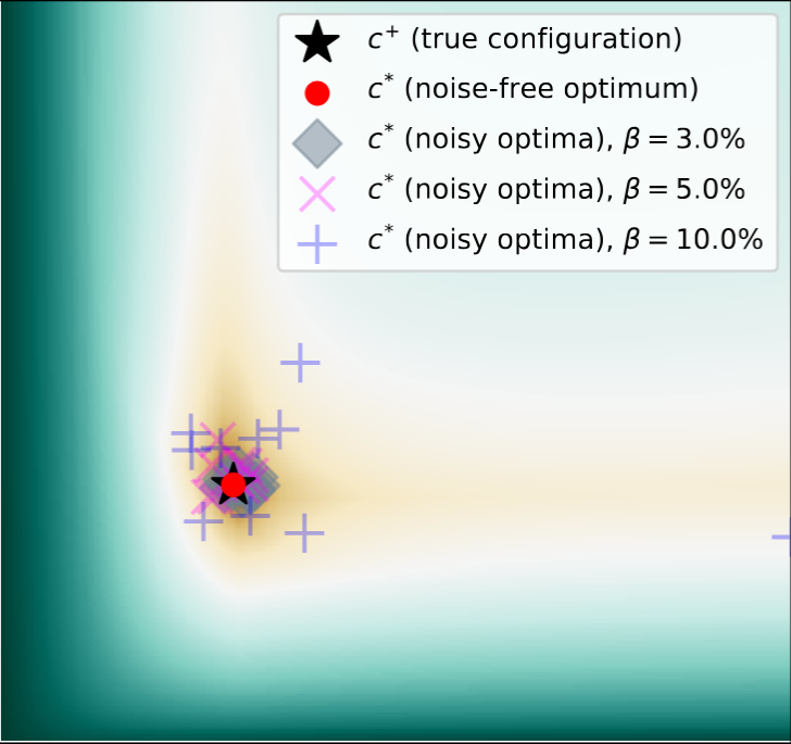
Ill-posedness of physical model inversion: We need to use satellite data to estimate meaningful Earth system parameters, but this often involves a model inversion procedure. While often considered ill-posed, we performed a systematic analysis, and found that this label is not appropriate for the model inversion. Instead, the inference problem itself presents as ill-posedness due to its high noise sensitivity.
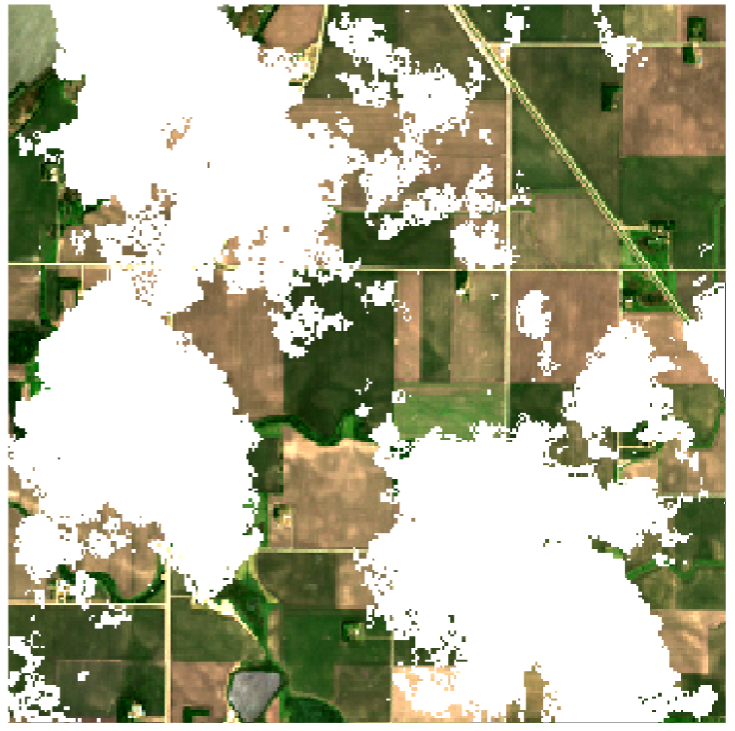
Training-free cloud removal for satellite data: Cloud cover obscures ground-level observations in up to 50–80% of EO imagery. In this project, we used and extended the VPint algorithm (see below) to automatically fill in cloudy data, which we found to be both more accurate and more efficient compared to other methods.
Spatial interpolation (VPint): Spatial and spatio-temporal data often contains patches of missing data or comes in the form of scattered point data, while full gridded data is preferred. In this project, we developed a novel spatial interpolation method (VPint), founded on a new system perspective over existing distance-based or local methods. We found VPint to perform and scale better than baseline methods.